Saturday, May 21, 2011

Byars - Stratford Oklahoma Tornadic Supercell 4-22-2011

It was just Justin Terveen and I this day since neither James or Colin could chase. James stayed at home and nowcasted for us and was a huge help in keeping us up to date on storm positions. 

A cold front was pushing south through Oklahoma and a dry line was stretched along and west of the I 35 corridor. After examining the models and the HRRR I couldn't really decide where I wanted to target. I figured the intersection of the dry line and cold front would be good, but I also wasn't sure if the cold front would undercut storms or not. So, while storms were likely along the cold front I wasn't sure if I would really want to chase them.

The HRRR showed several big supercells blowing up along the Red River, so I knew that I didn't want to miss something like that. With the cold front supposedly moving into Central Oklahoma and  anywhere along the dry line (especially along the Red River) being ideal for supercells I decided to target Ardmore. It would be a good place to reach anything that either blew up on the dry line or along the front.

We left my house in the Metroplex early (around noon) since I didn't know when storms were expected to fire. We got to Ardmore around 2pm and then waited. We waited and waited till boredom sank in.
I then decided to go to Turner Falls and take in the scenery there since I didn't know how long it would be till initiation of thunderstorms.

After taking in the scenery there  for a while we went back south to Ardmore and waited some more there. It was probably close to 4pm by the time I noticed a storm developing south of the Red River. It had just barely reached the tropopaus, but figured it would be the days play. So we blasted south on I 35 to target the Gainsville area.

It quickly became apparent that we weren't going to make it to the small cell I saw. But I figured I had at least found a decent initiation point along the dry line. There were many small cells trying to fire in that general area. But, by the time we reached Gainsville the storms had all collapsed. Bummer!

At the same time it became apparent to me that nothing major was going on south of the Red River the dry line/cold front intersection began to light up with storms up near Pauls Valley back in Oklahoma. So, we turned around and headed back into Oklahoma. It felt like we had just been "pacing" this stretch of highway all day.

The storms near Pauls Valley really took off by the time we got there (5:30ish ?). And after a quick supper break it was game on.

It was apparent that things were supercellular but the contrast was terrible.

The structure was actually quite good with a ground hugging wall cloud, but the contrast was so incredibly bad that photography seemed almost pointless. It didn't help that it was raining at our location either.

We stopped in the town of Stratford to watch the storm approach and see what would happen. After a while it became apparent that there were two dominate supercells and that the one further west was becoming the most dominate. The first wall cloud and meso we saw got swallowed up in the rain from the second to never be seen again. But as that happened the wall cloud from the second storm (now completely dominating) came into view.

We sat just east of Stratford on highway 19 and watched a breathtaking show take place.
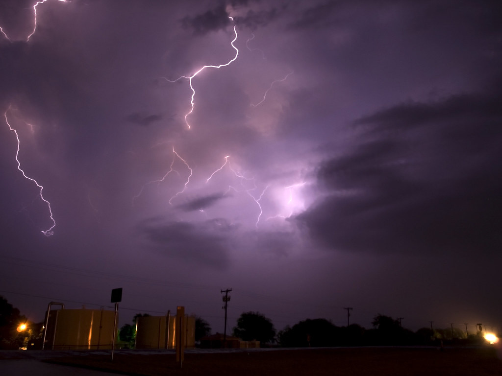
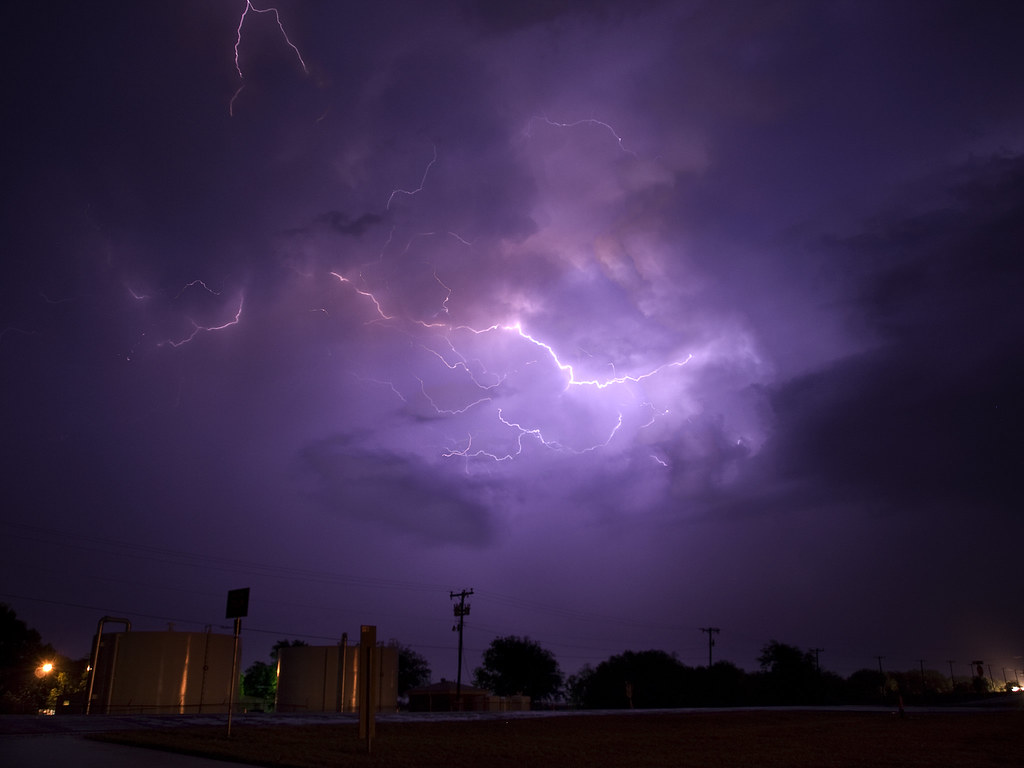
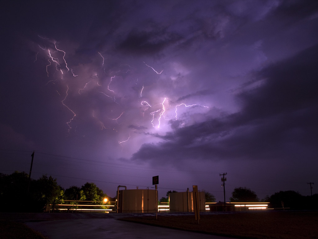
The lightning and been intense all day but now became really intense. In fact, it was really the most hazardous thing I had experienced up to that point. The strikes were close and so frequent that I captured this image... and didn't even know about the lightning bolt in it. 
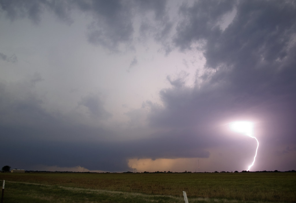
And while we had this view to the west-northwest we had a great view of mammatus to the south and east.


Several locals stopped on by to ask what the storm was doing.
I told the first guy that the wall cloud didn't look to have major rotation since it looked like it was primarily all inward rushing air at that point. However, I made sure to point out that I still thought it a bad idea to head in its direction.

The rising motions on the right side of the wall cloud were just incredible! Some of the fastest upward moving air I had seen since... well... since the previous chase with the tornado in Tushka.
And while it was not rotating at that exact moment (that we could see), that changed very quickly.
There was a sudden surge in the Rear Flank Downdraft (RFD) to the wall cloud's left that forced the area into a tight counter-clockwise circulation.

This large panorama of the entire storm base shows how wrapped up the storm was getting. The wall cloud in the previous image is on the right side of the mesocyclone near the very bright light filtering through the heavy rain. It had just started to rotate violently. And at this point I was convinced there was a tornado in there.


This radar image is at about the same time as the panorama and you can really see the tightly wound hook. We are just barely east of Stratford in this image.

While it is unlikely that Justin or I actually saw any of the two tornadoes produced we were sure convinced that one was present. We sat along 19 just east of Stratford for too long with the lightning getting steadily closer. And I certainly spent too much time outside the vehicle.
I think it was when I saw lightning strike the Stratford water tower that I decided to get into the car. Justin got an amazing time laps at this location with the nearly continuous lightning.

I finally decided to get the heck out of there (with some encouragement from James our nowcaster) and dropped straight south out of Stratford to get away from the lightning and away from the violent, rain-wrapped, something.

We stopped near a cemetery along 177 several miles south of Stratford and observed the storm from there. Justin got another amazing pano from that location of a spectacular mothership HP mesocyclone of awesomeness.

This is what the storm now looked like on radar. With the small town of Stratford taking an apparent direct hit by the storm. The rotation is now over the portion of highway 19 we had just been on.

As far as I know there were no serious injuries from this storm and the damage to Stratford was much less than what I would've expected to see from a radar presentation like that. The tornadoes that were produced were brief and not very strong it seems. And they mostly occurred outside of town. Its always nice to know that the storm you chased didn't cause any serious harm.

James suggested that we get a move on and so we did. However, I was eager to get back to I 35 and take it south and decided to take highway 29 over to I 35. I probably shouldn't have done this, but figured we'd have just enough time to do it. It turned out we did, but I made a critical error right at the end.

Highway 29 merges for a second with 77 and both turn to the north. Then 29 splits off and goes west again to I 35. I didn't realize we had turned north and thought that the sign said to go straight to get to I 35. So instead of heading west we headed north right into a weaker storm. Visibility was near zero and James had to help me figure out why I had not reached I 35. So, I had to turn around and get back to where 29 splits off. Once I did this we were out of the rain quickly and able to shoot some lightning in the Arbuckle mountains near Davis.

We ended the chase on another distant supercell well west of I 35 (that James had informed us about) and shot lightning from it for a while. Most of those images didn't work out so well for me as I had a slight focusing error and most of (if not all of) the bolts were too distant to really capture.
But, still it was a fun way to end the evening.


Here is a radar loop of the supercell.


Monday, May 16, 2011

4/14/2011 Tushka Oklahoma Tornadic Supercell and some Lightning.

If the last chase event was memorable than this one certainly was.

This was another one of those "wake-up-call" type chases with this one involving the destruction of the town of Tushka Oklahoma. And surprisingly most storm chasers would consider it our most successful to date. I am kind of debating that since July 12th 2010 yielded much more beautiful photographs for us.

I was not at all expecting to chase this day and neither was James Langford. I had a physics lab that was supposed to go until about 5pm that afternoon and James had something else going on. But, wonder of wonders, I got out of lab early (around 3:30?) and James also got finished with (whatever it was he was doing) at about the same time.

He called me about the time I got out of lab (or I called him, can't remember) and he toled me that storms were already erupting on the dry line in Oklahoma. So, we decided to go ahead and make a quick run up 75 just to see what we could see. Justin Terveen also came with us.

There were a lot of storms up in Oklahoma but only one of them was really significant and it was the southern most one with the most unobstructed inflow. When we began our trip up 75 to basically target the area north of Durant Oklahoma the storm of interest was due north of Lake Texoma and drifting slowly east-northeast.  The chasers already on this storm got some amazing structure shots, but as it continued eastwards contrast under the storm began to decline.

We made it north of Durant just about the time the most intense circulation was fixing to cross the road. While we could see the supercell's overall structure the contrast was indeed terrible.


After grabbing some images here we decided that, just for kicks, we would drive underneath the base and see what was going on (sound familiar?).

From this point on I was focused on videoing our trip into the beast rather than taking stills. When we crossed underneath the meso there was a pronounced RFD cut... probably one of the most impressive ones I had seen up to this point (I say that about everything don't I?). As we drove further north a significant lowering emerged out of the merkey darkness ahead. Given its location under the storm  (north of the RFD with the RFD wrapping around the south side of it) I knew that it had to at least be a significant wall cloud. When it took on a distinct cone shape as it crossed 75 everything about it was screaming TORNADO. I was almost screaming tornado and I am not sure how I managed to sound so relaxed and composed on the video. The funny thing was is that James and Justin couldn't even see it due to the contrast being so bad on it. (James was focused on the road, and Justin was in the back seat).

As we got close enough to the feature to really see the spin we pulled over to the side of the road and filmed the rapidly rotating color cloud around the multi-vortex tornado and some of the vorticies underneath. I had never seen rotation on that scale before that close up. Despite this I was still second guessing myself about it actually being a tornado (the contrast never was that great and though I thought the feature was only about a mile or so away it was more like three or four).

We decided to continue on up 75 just to see if it indeed had been a tornado. And sure enough we crossed into a distinct damage path left be the tornado as it crossed the road.

The tornado was aparantly fairly wide since the damage just didn't end.

Looked like a weedeater tore through the area with all the trees snapped off at about the same hight.

It was about this point we decided to flip around. We thought that Atoka must have taken a hit and decided it would be best to flip around as soon as possible. What we didn't know was that, although the south side of Atoka apparently did get grazed, it was a small town called Tushka south of Atoka that took the brunt of the tornado. We really had no idea the town was even there as you couldn't really see much from 75.

We flipped around at probably the last place one could before the backup on 75. At that location a semi had been flipped but thankfully it appeared that the driver was ok with many people standing around. It sure didn't seem like we would be of any use there blocking even more traffic when many were already stopped along that stretch of road.

Once we flipped around we shot the storms well to the west that had developed along the steadily approaching dry line/cold front merger. We had a pretty decent display of lightning and mammatus in the fading light. (Though I didn't get much of the mammatus or the lightning).

This is a vertical panorama of the new cell due west of us with lightning and some mammatus.

I don't really know how long we sat at that spot along 75 south of Tushka but it was probably at least an hour. We were all kind of in some sort of state of "shock" or something. I was kind of flip flopping from between "wow we actually saw a tornado!"  and "oh my gosh thats a lot of ambulances." There were a lot of ambulances that came north the entire time we were trying to photograph lightning. And it really drove home the point that while I really enjoy these storms someone else doesn't. I still can't seem to quite grasp what the appropriate response to something like this is. Especially when you originally came out for a good time and nothing more.  But we still didn't know that Tushka had been demolished (though the number of ambulances definitely indicated that something major had happened).

To wrap up the chase we headed back down into Texas with a squall line rapidly blowing up on what was now the cold front. We stopped in northeast Collin County and let it run us over. That was quite fun with the marble size hail and frequent lightning. The lightning on the backside was actually surprisingly good, and extremely frequent. So frequent that it was hard to get a bad shot.


The next day there was a big discussion amongst the three of us about the event and how we should be better prepaired for this stuff. As it turns out not only was Tushka severely damaged but police, fire, and EMS were overwhelmed. On Storm Track and on Spotter Network there was a call for any chasers in the area to lend a hand with the search and rescue due to the overwhelmed officials. Since we didn't have the lap top that day we had no idea that any of this was occurring and it stung. (At least to me it did). I generally have the idea that one should avoid disaster scenes as much as possible... but that isn't the case when any help is called for and one is able to lend that help. The bigger question now is whether we could've even been of any help and an even bigger question is what to do when this sort of thing happens in the future.

As a chaser for me it is all about enjoying the storms and getting a good photograph. But, unfortunatly, that is the view held be 99% of all chasers (even the ones claiming to provide life saving information). Most chasers do not even call in a tornado when it occurs but instead reach for the camera. It just doesn't seem to make since trying to get a clear report through to the NWS when the road is packed with chasers all watching the same tornado. Surely several of them have already reported it right? WRONG! Or at least wrong has been the answer on numerous events I have heard.

I will say that there were many chasers who did assist in the search and rescue efforts that evening thanks to the news of the disaster spreading quickly amongst them. 

Any way, as far as personal convictions I hope to attempt to put reporting and being ready to assist in higher priority. Well see if I actually learned anything I guess. 
This event did also spark more thought provoking questions about the sovereignty of God and why he allows (or causes) these things to happen. I mean, I always try to give him the glory whenever a forecast is successful (I suspect someone is laughing at this since I hardly ever openly state such and certainly don't act like it or I may even forget to) since it is he that brings all this about in the first place. And though it was awesome to be on such an awesome storm its also tough to swallow the fact that the same thing that caused me happiness killed at least a couple of people, injured many more, and left many more homeless. 
And now I don't know where exactly to go with all this since it is now 2:30am and that gives me a good excuse to drop the ball here. 

I still enjoy storms and chasing... can't get over that. 

Wednesday, April 13, 2011

Storm Chase 4/8/11 And a Close Encunter to... Something...

 Would I call this a successful chase? 

Yes

Were amazing storms witnessed?

Yes

How about the photography? Was it good?

For me? errr... No... not really. 

Was it fun?

Yes

Were we almost killed because we were dumb enough to drive underneath the base of a massive tornadic supercell at 11:00pm?

Probably not but can't say with any certainty... and not all the facts are in.     o_0

Chased with James Langford, Justin Terveen, and Colin Miller. 


This was probably one of the more unique chases I have had thus far. And I think it was one of the more educational... and that is not necessarily a good thing.

So, we had a target picked basically northwest of Oklahoma City. Dry Line was expected to push east in the late afternoon with an impulse in the upper flow expected to help erode the cap.  There would be strong surface heating making this easier and dew points were generally well into the sixties... especially east of I 35. One thing we were lacking some what was low level shear and helicity, but there was a nice boundary (warm front) along the Oklahoma/Kansas boarder that would come into play and provide some of those ingredients late in the period.

In reality we had not completely settled on northwest of Oklahoma City. Any where along the dry line was fare game as far as we could tell and the dry line stretched from Kansas to Texas through Oklahoma... way to much area to target obviously. So, what did we do? We sat in Norman at a McDonalds and leached there Wi-Fi. We took a look at the HRRR and what did we see? A massive cluster of supercells firing basically between I 44 and I 40. The biggest developed near Lawton paralleled I 44 and moved just south of OKC. So, thinking the HRRR was onto something we decided we would stay south of Oklahoma City and wait for this monster to emerge from near Chickasha.

 Since we didn't want to have to cross OKC (I am sick of typing Oklahoma City... such a waste of space ya know) in rush hour traffic we decided that it would be best to stick to one side or the other. And since the HRRR wanted to play a joke on all the chasers dumb enough to believe it we decided to stay south of OKC.

While the HRRR was not wrong in the type of storms it developed nor there areal coverage, it was wrong in there placement. The HRRR turned out to be about 150 miles to far south... go figure.

By 4pm-ish (or perhaps a little later) towers began to build west of Oklahoma City and the El-Reno area. We decided to head west and possibly make the turn south towards Chickasha. We noticed on Radar scope that chasers were packed along I 40 and north of there. We then also noticed as we headed west towards the Union City area that reflectivity was beginning to show up north west of El-Reno. We also noticed towers exploding over head and especially north west. It was becoming clear that the action was going to be further north than originally thought. We decided to take highway 81 north through El-Reno and see if we couldn't catch the developing convection.

Unfortunately it was about 30 - 40 miles to our northwest and moving north-northeast at about 40mph. (At least initially). Another tower exploded just to our west as we got lost and wandered around El-Reno looking for the stupid SR 81. This tower fell apart and the convection well to our northwest was exploding into a massive supercell. We decided to chase it as we didn't know if it would be the only one worth chasing or not.

As we raced towards Hennessey another storm developed way west of us and since we were not crazy about the idea of trying to race the first supercell down along with all the rest of the storm chasers in Oklahoma we decided to target the west cell. This was both a good choice and kind of a bad one.

First, we were in a much better position on the the western cell and could catch it much more easily. The bad news was that for some reason (probably due to lower helicity and or lower moisture content) this storm took forever to organize.

We chased it while the first supercell (now off to our northeast) continued to look amazing from a distance. And our storm (near Fairview)... well... didn't seem to have any organization. It split multiple times and these "left splits" were more intense than the "right split" we stayed with. We even core punched it due to its weakness. We drove all around underneath it looking for any tail-tell signs of  mesocyclone development. But none-emerged... until sunset.


At that point we had almost given up. We had found a storm and it looked kind of neat. It had dime size hail that had pelted our car, and it had given us something nice, at least, to look at. But our expectations had been so much more. (At least mine). BUT... as we let the storm drift to our north so that we could shoot what we could in the fading sunlight, an obvious change began to take place in this disorganized cluster of storms.
One of the predominate ones was an inflow band coming straight into the storm from the east. Another, the lowering of the cloud base (possibly due to a combination of surface temperatures cooling along with more moist air advection). Those wonderful little anvil crawlers (or anvil zits as we like to call them) started to really show up in the fading light.

We moved north with it to find a closer place to shoot photos hoping for lighting shots as the light faded. It was here that the most dramatic change in the storm occurred.
 A large wall cloud developed. And compared to the rest of the storm base it was practically hugging the ground. What we were watching was the development of a strong mesocyclone that would produce at least one tornado (confirmed by another chaser's pictures).


The interesting thing is this storm continued to have a multi-cellular characteristic while at the same time developing strong supercellular characteristics. This lead to multiple mesocyclones in fairly close proximity to each other. This showed up on radar as more of a line of supercells merged together in a line running east to west, moving to the east. Each with its own little hook area, and each had its own wall cloud visually. 
The first was large and showed sings of increasing organization the entire time we watched it.


 While we watched this wall cloud pass off to our north another formed to our northwest and fallowed the same path as the first. It also steadily increased in impressiveness as it passed to our north.


Here both wall clouds can be seen, with the first being the hardest and off to the right. 


While these images were not all that great it made the trip worthwhile to see this. We soon decided to call it a night and head back to I 35 to begin the return trip home. However, the moment we left it and started heading back east on highway 412 a tornado warning was issued for the storm. The lead rotation had dominated and began to wrap up a nice hook on radar. Since it was going to cross I 35 not too far to the north of 412 we decided to go ahead and race it to I 35. This would've been a lot easier if the town of Enid had not been in the way... but you can't have everything.
Once we reached I 35 we shot straight north towards the storm with the thought that we would at least try for some lightning again. 

We stopped at some truck stop or gas station along I 35 and tried to shoot some of the anvil lightning which was insanely frequent. But a mid-level cloud band was already rotating around the storm and overhead blocking our view of the bolts. 

Here is where the story gets interesting.
I have tried to pay careful attention to this part as it will probably impact how we handle night time events in the future.


At this point the tornado warning had been allowed to expire and we decided to head up towards the storm base again just to see if anything was going on. The point was not to get close to anything, but to simply see if any structure could be viewed in the downdraft/updraft interface.

We drove up under the storm base trying to maintain what we thought would be a safe distance. I figured that since we were experiencing decent outflow winds and that the main area of rotation remained a few miles to the north we were fine. There were lowerings all under the storm base... but none of these I was too worried about as most of them were just scud, or outflow clouds.

But, as we were looking for an exit to pull off the highway onto in order to watch the main area of rotation to the north, Colin announces that he sees a funnel due west or west-northwest of us. Hmmmm... I look out that way and can't see anything. Since I was on the east side of the vehicle I really can't see what he sees. James also sees something and pulls the vehicle over. Colin then reports that whatever he has seen has lifted for the most part but a lowering was still present. 
I stick my head out of the window to get a view over the car to the west. I don't see anything that made me overly suspicious. There were several lowerings on the horizon... none of which looked especially menacing or organized.  Colin insisted that whatever he saw was still present and that we needed to find a way to turn around. This would be difficult since the nearest exit (the only one we had seen for miles) was about 1/4 of a mile up the road. Colin and James didn't know if we could make it there before the lowering passed over the general area. 

While the debate as to what to do was taking place I finally began to notice what Colin had, but at first it still didn't impress me. But then the lowering began to take on an obvious wall cloud shape. There even looked to be an RFD cut immediately to the south of it. The outflow we were experiencing was from this down draft area and it was picking up speed. The wall cloud also was not moving but remaining in a fixed position under the storm base (another sign of very suspicious activity). James, after attempting to snap a few pictures of the wall/funnel cloud (to help us get a better idea of  what it looked like) decided that staying put was not safe... nor would trying to cross the medium to make a u-turn (both illegal and would likely get us stuck... with the latter reason carrying the most weight in the present situation). 

We made the drive up to the exit and as we approached a strong wind shift was noted. First we had winds out of the west coming out of the downdraft immediatly to our left. Then we had winds whip around to the east and get fairly strong. This coincided so well with what I had seen above that I was now fully convinced that we had indeed witnessed and driven through a circulation of some kind. Once we got flipped around on the highway the lowering was already either on or just east of the road. Since the lightning remained to the west and north the lowering was front lit and therefore completely invisible. I believe we gave it a minute or two before we headed straight back south on I 35 to begin the long journey home. 

Once the storm had crossed I 35 it went tornado warned again and became an absolute monster. It developed a very large and impressive circulation on radar. The towns of Tonkawa and Ponca City were pounded during the time we had spent under the storm with one report of 94 mph winds and baseball size hail in the general area to our north. 
It really was a blast all around and am very glad we made the trip into Oklahoma. But we did make a number of mistakes and only have God to thank that a full blown tornado didn't make minced meat out of us on I 35. 


Thursday, April 7, 2011

Preparing to chase on 4/8/2011


This is certanly not the best set up I have ever seen but it is one which we will be chasing nonetheless.

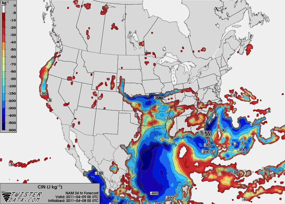
Models are forecasting a decent capping inversion to be in place during the early afternoon, but erode it away in places along a dry line running through Central Oklahoma. The most recent run of the NAM has actully pushed the dry line further east before stalling it in the evening. The seems to me to indicate some possible lift along it.

Dry Line position by 7pm can be clearly seen here.

CIN looks to be weakest near and north of Oklahoma City. But is weak all along the dry line.

There does appear to be some kind of disturbance moving through at 7pm in the 500mb level.


From what I can understand most think that this will not be much of an event. But given the strength and amount of deep layer shear Supercell storms would be likely if convection can develop. I think we will be targeting Ardmore Oklahoma to start with and then see where to move from there.

Sunday, March 20, 2011

Wait... is it March or July?

Take a look at these convective outlooks from the Storm Prediction Center.
Day 1
Day 2
Day 3
Hey, now thats more like it...


Except the main action is still expected to be way north.
Day 4

These outlooks look to me like they belong to either June or July... not March! How dare the central plains get their severe weather before us down here in the south! Oh well. I guess I should blame La Nina like everyone else. Still that is pretty strange to me. Hopefully the drought across Texas can get some relief.

Friday, March 18, 2011

3/21 falls apart.

Looks like the whole thing has pretty much gone ka-poot!

Cap looks like it will be too strong, and the system is too far north in Kansas.
The models have consistently been shifting this thing north with the past few runs.

Any way, the only real chance at storms appears to be Wednesday evening. But, flow looks like it could be a little too veered along the front for decent convergence along it.

Wednesday, March 16, 2011

Potential Storm Chase 3/20 - 3/21

It looks like there will be a decent opportunity for supercells in far West Oklahoma and Texas panhandle Sunday through Monday. SPC has already outlined an area Saturday through Sunday.

I am actually most interested in Monday since chasing that day will be easier and it appears that it could have the most potential.

The ECMWF shows a nice surface low sitting over Southwest Kansas on Monday with a dry line extending south through the Texas panhandle. I can't tell how the wind vectors at the surface are aligned, but I have some hope that winds are not terribly veered along the dry line.


The GFS tells a slightly different story with a much weaker surface low and the main trough holding back further west. At least the moisture return is not expected to be the main problem.

The trough can be seen here further west and most of the disturbances well west and north of the target area. This might imply an even later set up... perhaps Tuesday, or even later. It also would likely mean that the best target would actually be in southern Kansas closer to the warm front and dry line bulge that can be seen on the dew point map.

CAPE is not overly impressive ether... but as some have pointed out the models have often underforecasted the CAPE. I won't bother to show it but there is also a pretty stout cap in place and it will be very hard to overcome that without some kind of upper level disturbance.

At least it is again something to keep a close eye on. All we really need is more instability... especially less CIN. Shear profiles look more than adequate for supercells.