A cold front was pushing south through Oklahoma and a dry line was stretched along and west of the I 35 corridor. After examining the models and the HRRR I couldn't really decide where I wanted to target. I figured the intersection of the dry line and cold front would be good, but I also wasn't sure if the cold front would undercut storms or not. So, while storms were likely along the cold front I wasn't sure if I would really want to chase them.
The HRRR showed several big supercells blowing up along the Red River, so I knew that I didn't want to miss something like that. With the cold front supposedly moving into Central Oklahoma and anywhere along the dry line (especially along the Red River) being ideal for supercells I decided to target Ardmore. It would be a good place to reach anything that either blew up on the dry line or along the front.
We left my house in the Metroplex early (around noon) since I didn't know when storms were expected to fire. We got to Ardmore around 2pm and then waited. We waited and waited till boredom sank in.
I then decided to go to Turner Falls and take in the scenery there since I didn't know how long it would be till initiation of thunderstorms.
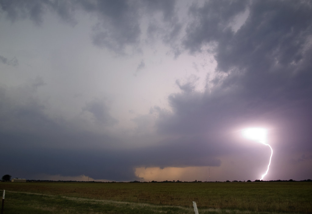
After taking in the scenery there for a while we went back south to Ardmore and waited some more there. It was probably close to 4pm by the time I noticed a storm developing south of the Red River. It had just barely reached the tropopaus, but figured it would be the days play. So we blasted south on I 35 to target the Gainsville area.
It quickly became apparent that we weren't going to make it to the small cell I saw. But I figured I had at least found a decent initiation point along the dry line. There were many small cells trying to fire in that general area. But, by the time we reached Gainsville the storms had all collapsed. Bummer!
At the same time it became apparent to me that nothing major was going on south of the Red River the dry line/cold front intersection began to light up with storms up near Pauls Valley back in Oklahoma. So, we turned around and headed back into Oklahoma. It felt like we had just been "pacing" this stretch of highway all day.
The storms near Pauls Valley really took off by the time we got there (5:30ish ?). And after a quick supper break it was game on.
It was apparent that things were supercellular but the contrast was terrible.

The structure was actually quite good with a ground hugging wall cloud, but the contrast was so incredibly bad that photography seemed almost pointless. It didn't help that it was raining at our location either.
We stopped in the town of Stratford to watch the storm approach and see what would happen. After a while it became apparent that there were two dominate supercells and that the one further west was becoming the most dominate. The first wall cloud and meso we saw got swallowed up in the rain from the second to never be seen again. But as that happened the wall cloud from the second storm (now completely dominating) came into view.
We sat just east of Stratford on highway 19 and watched a breathtaking show take place.
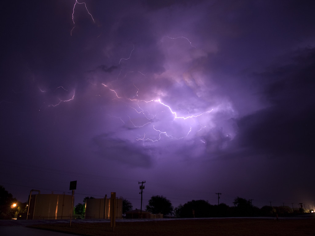
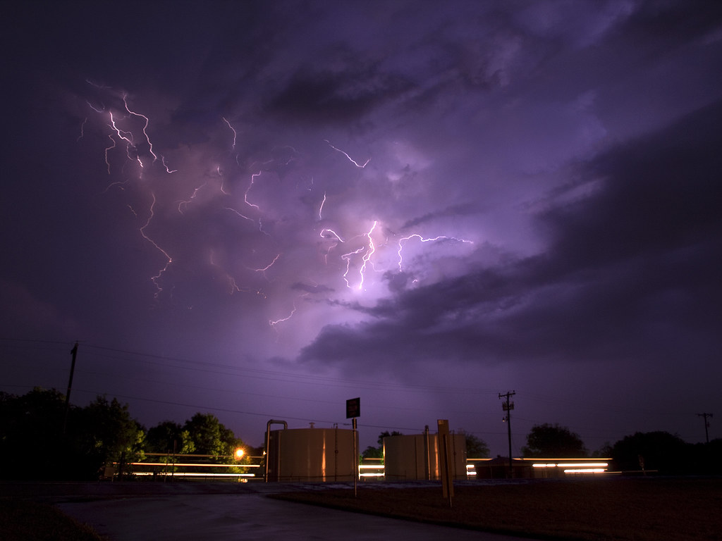
The lightning and been intense all day but now became really intense. In fact, it was really the most hazardous thing I had experienced up to that point. The strikes were close and so frequent that I captured this image... and didn't even know about the lightning bolt in it.
And while we had this view to the west-northwest we had a great view of mammatus to the south and east.

Several locals stopped on by to ask what the storm was doing.
I told the first guy that the wall cloud didn't look to have major rotation since it looked like it was primarily all inward rushing air at that point. However, I made sure to point out that I still thought it a bad idea to head in its direction.

The rising motions on the right side of the wall cloud were just incredible! Some of the fastest upward moving air I had seen since... well... since the previous chase with the tornado in Tushka.
And while it was not rotating at that exact moment (that we could see), that changed very quickly.
There was a sudden surge in the Rear Flank Downdraft (RFD) to the wall cloud's left that forced the area into a tight counter-clockwise circulation.
This large panorama of the entire storm base shows how wrapped up the storm was getting. The wall cloud in the previous image is on the right side of the mesocyclone near the very bright light filtering through the heavy rain. It had just started to rotate violently. And at this point I was convinced there was a tornado in there.

This radar image is at about the same time as the panorama and you can really see the tightly wound hook. We are just barely east of Stratford in this image.

While it is unlikely that Justin or I actually saw any of the two tornadoes produced we were sure convinced that one was present. We sat along 19 just east of Stratford for too long with the lightning getting steadily closer. And I certainly spent too much time outside the vehicle.
I think it was when I saw lightning strike the Stratford water tower that I decided to get into the car. Justin got an amazing time laps at this location with the nearly continuous lightning.
I finally decided to get the heck out of there (with some encouragement from James our nowcaster) and dropped straight south out of Stratford to get away from the lightning and away from the violent, rain-wrapped, something.
We stopped near a cemetery along 177 several miles south of Stratford and observed the storm from there. Justin got another amazing pano from that location of a spectacular mothership HP mesocyclone of awesomeness.
This is what the storm now looked like on radar. With the small town of Stratford taking an apparent direct hit by the storm. The rotation is now over the portion of highway 19 we had just been on.

As far as I know there were no serious injuries from this storm and the damage to Stratford was much less than what I would've expected to see from a radar presentation like that. The tornadoes that were produced were brief and not very strong it seems. And they mostly occurred outside of town. Its always nice to know that the storm you chased didn't cause any serious harm.
James suggested that we get a move on and so we did. However, I was eager to get back to I 35 and take it south and decided to take highway 29 over to I 35. I probably shouldn't have done this, but figured we'd have just enough time to do it. It turned out we did, but I made a critical error right at the end.
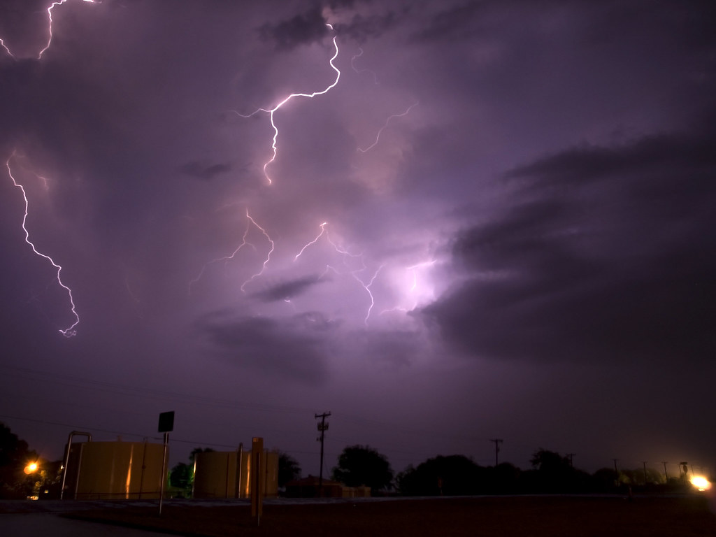
Highway 29 merges for a second with 77 and both turn to the north. Then 29 splits off and goes west again to I 35. I didn't realize we had turned north and thought that the sign said to go straight to get to I 35. So instead of heading west we headed north right into a weaker storm. Visibility was near zero and James had to help me figure out why I had not reached I 35. So, I had to turn around and get back to where 29 splits off. Once I did this we were out of the rain quickly and able to shoot some lightning in the Arbuckle mountains near Davis.


We ended the chase on another distant supercell well west of I 35 (that James had informed us about) and shot lightning from it for a while. Most of those images didn't work out so well for me as I had a slight focusing error and most of (if not all of) the bolts were too distant to really capture.
But, still it was a fun way to end the evening.
Here is a radar loop of the supercell.